GEOCOLOR Loop

Sandwich Loop

Band 8 (Upper Vapor) Loop

GLM Loop

(use responsibly.)
Click on any image to jump to it in a new tab.
Jump to: Satellite Imagery | Current Obs | Forecast Guidance | Forecast Submission | Climo | Long-Range
For other bands and higher res imagery, go here.
GEOCOLOR Loop
Sandwich Loop
Band 8 (Upper Vapor) Loop
GLM Loop
Loading...
Latest Surface Analysis

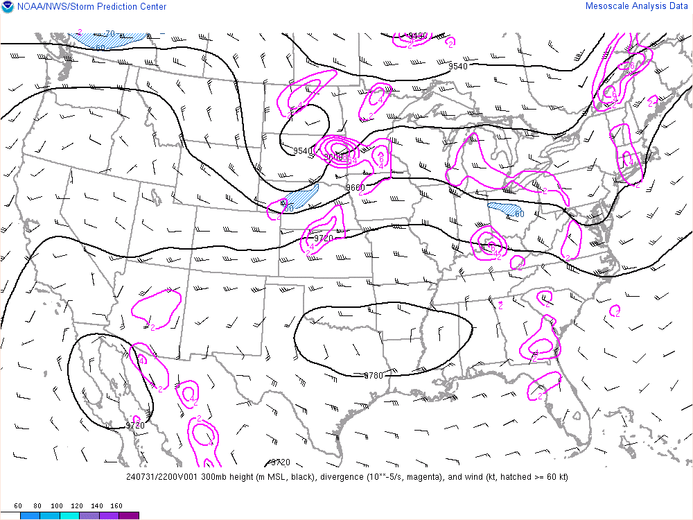
300mb Heights
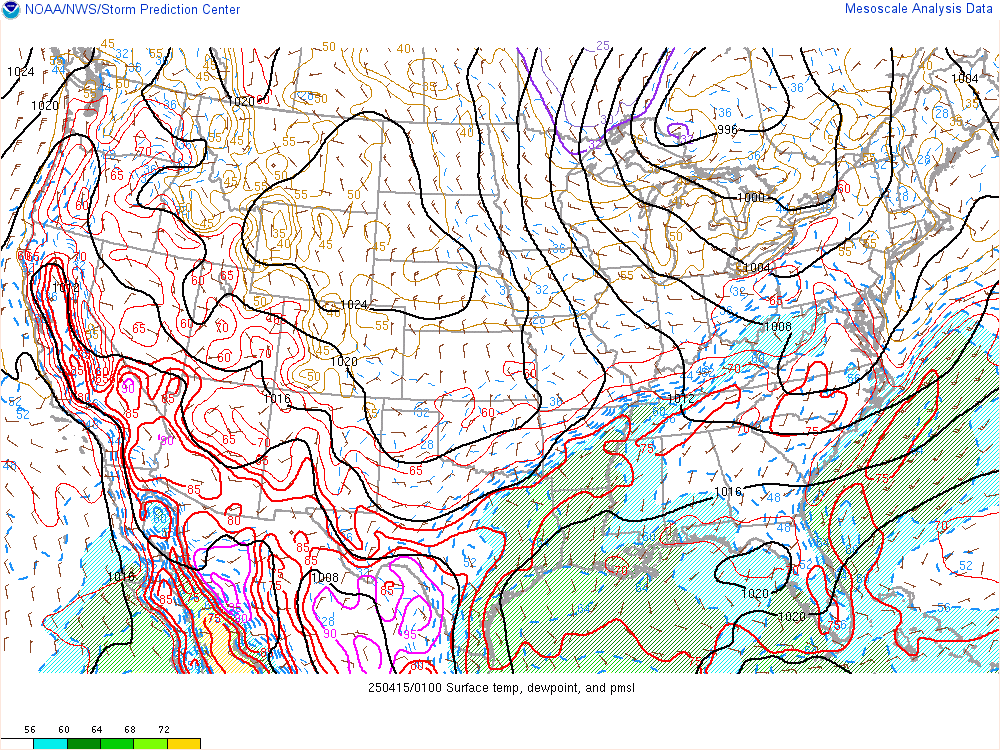
Surface Temp, Dewp, MSLP
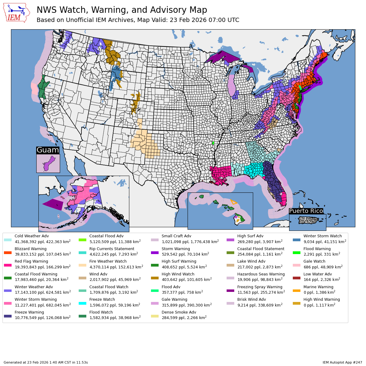
Nationwide Alert Map
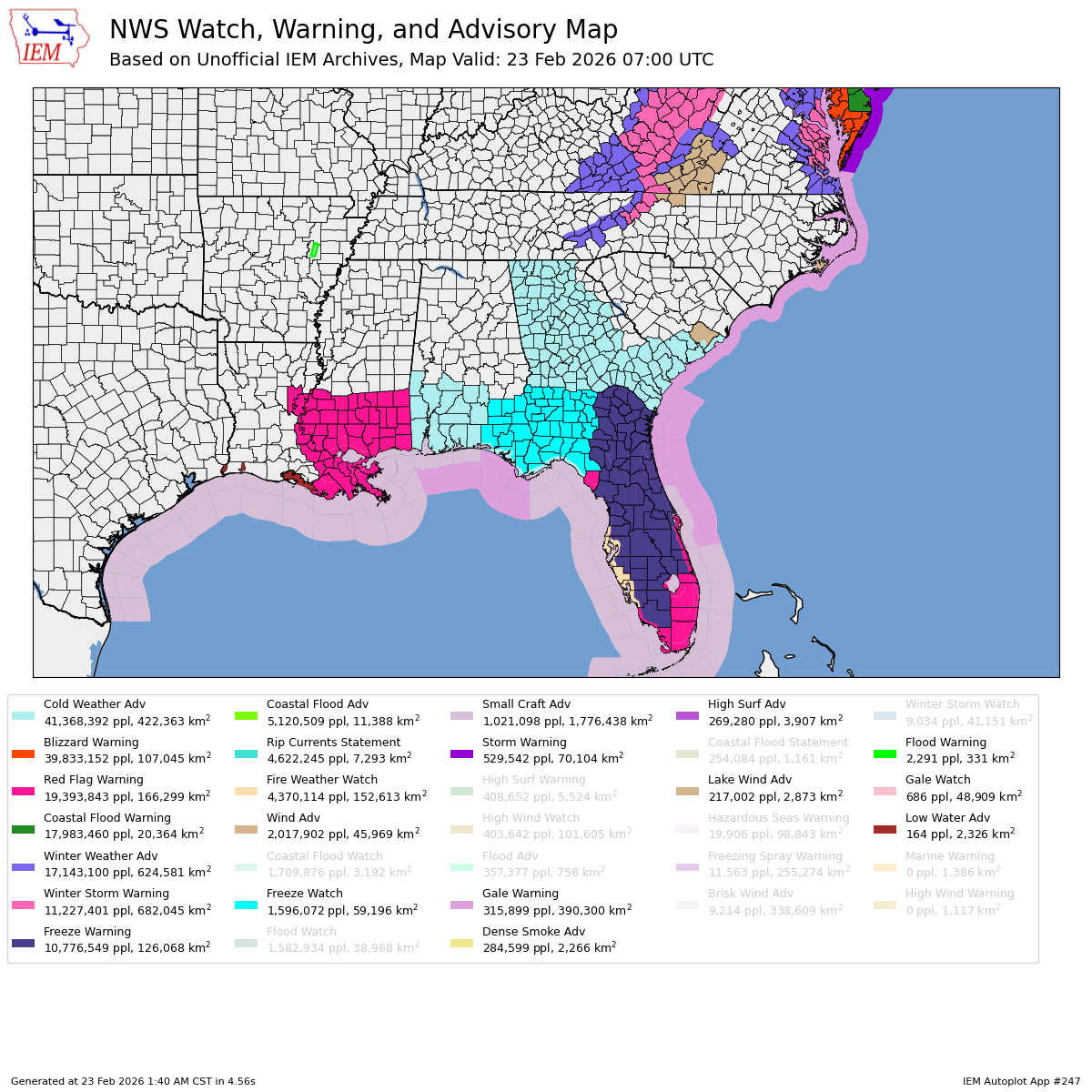
Southeastern Alert Map
National Reflectivity Loop

Southeast Reflectivity Loop

Nationwide Drought Monitor

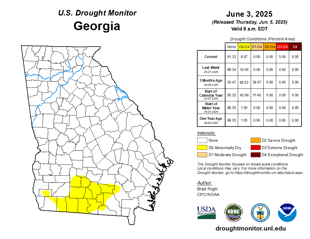
GA Drought Monitor
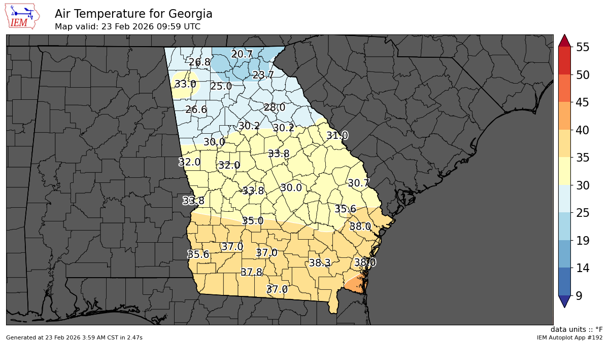
GA Temp Map (from METAR sites)
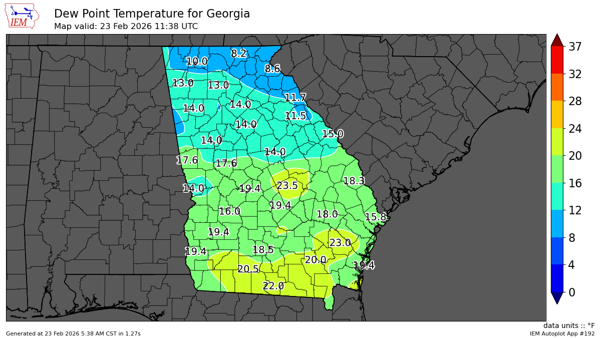
GA Dewp Map (from METAR sites)
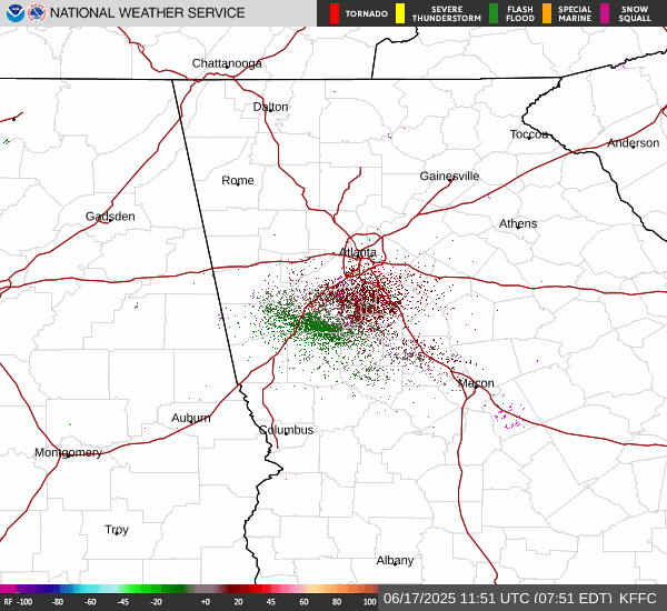
KFFC Reflectivity Loop

KFFC Velocity Loop
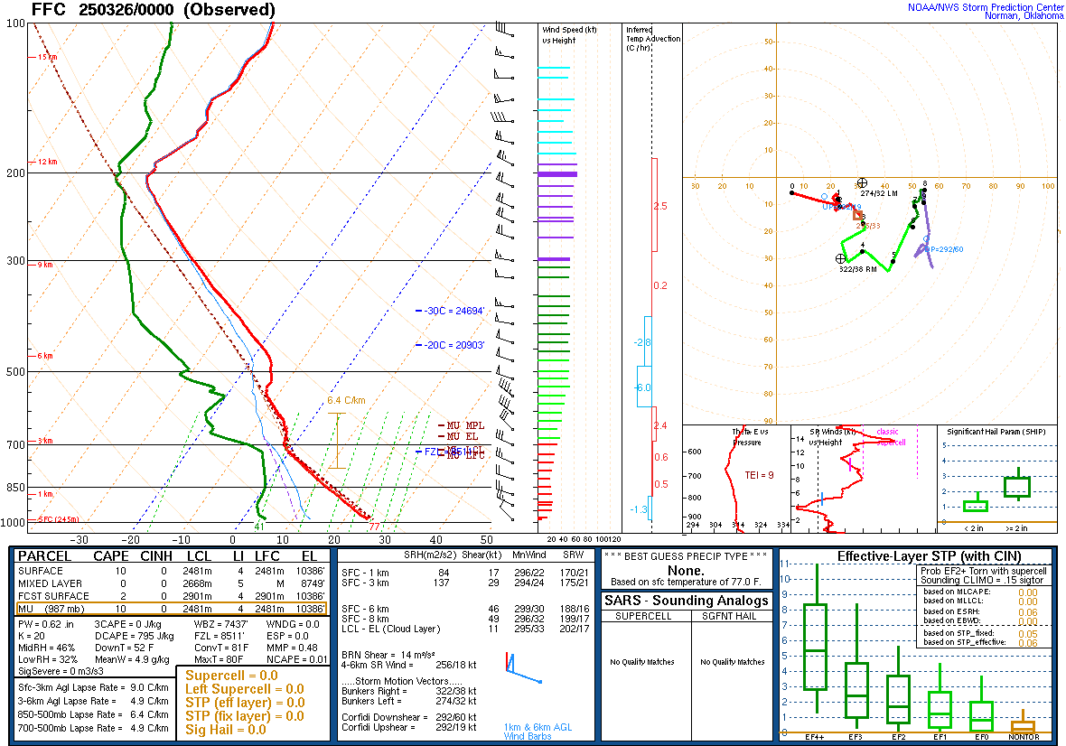
Latest FFC Sounding
Eventually, I want to embed some models in here...
UGA-WRF | UGA-MPAS | NBM MOS | WeatherBell | Tidbits | DuPage
Latest WRF Model AHN Meteogram

Latest WRF Model CNI Meteogram

NWS FFC Discussion
USE RESPONSIBLY!!!!
Loading...
NWS FFC HWO
USE RESPONSIBLY!!!!
Loading...
awaiting forecast...
xmACIS2
KAHN Climate Summary
Loading...
KATL Climate Summary
Loading...
CPC 6-10 Day Temp Outlook

CPC 6-10 Day Precip Outlook

CPC Monthly Temp Outlook

CPC Monthly Precip Outlook

This page refreshes automatically every 10 minutes.


